
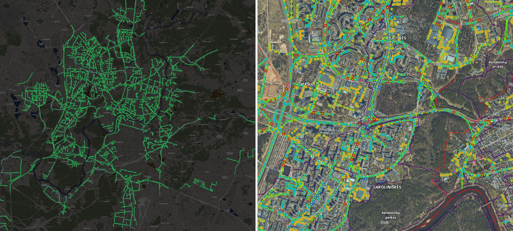
Vilnius is home to the largest stormwater network in Lithuania, with more than 1,700 km of pipes and 17,500 manholes.
In this 3D laser scanning case study you will discover how Terra Modus, a company specialising in 3D laser scanning and photogrammetry, tackled the challenge of measuring the largest stormwater system in Lithuania. Conventional methods would have taken 5 years, but by using high-end 3D laser scanners, bespoke hardware and their own software Undet, they were able to overcome numerous technical challenges, including limited access to the manholes and new method of georeferencing. In the process, improving productivity tenfold (from surveying 8 to 80 manholes per day) and completing this unique project in just 6 months.
Vilnius is home to the largest stormwater network in Lithuania, with more than 1,700 km of pipes and 17,500 manholes.
Stormwater management is a job that is invisible to the naked eye, the importance of which most people only learn when their street becomes flooded after a heavy downpour. As a city grows and develops, the amount of water entering the stormwater system grows, placing added pressure on existing and often aging infrastructure.
Vilnius is home to the largest stormwater network in Lithuania, with more than 1,700 km of pipes and 17,500 manholes. This vast network has long been in need of an accurate assessment to see how it functions in day to day use. However, using conventional methods and tools it was estimated that it would take one specialist almost 5 years to complete this task.
3D laser scanning technology is a process that uses high-end 3D laser scanners to collect and measure data points from a specific environment or object. The scanner sends out a laser beam that reflects back to the device, allowing it to calculate the distance and position of each point on the surface of the object. In the context of measuring and modeling stormwater systems, 3D laser scanning technology can be used to capture detailed and accurate data about the physical structure and condition of the system, including pipes, manholes, and other components. This data can then be used to create 3D models and simulations of the system, which can help in assessing the hydraulic capacity and identifying potential problems.
Vilnius is home to the largest stormwater network in Lithuania, with more than 1,700 km of pipes and 17,500 manholes
This project was characterised by the fact that it was necessary to solve a multitude of technical issues that required equipment and methods that simply did not exist on the market.
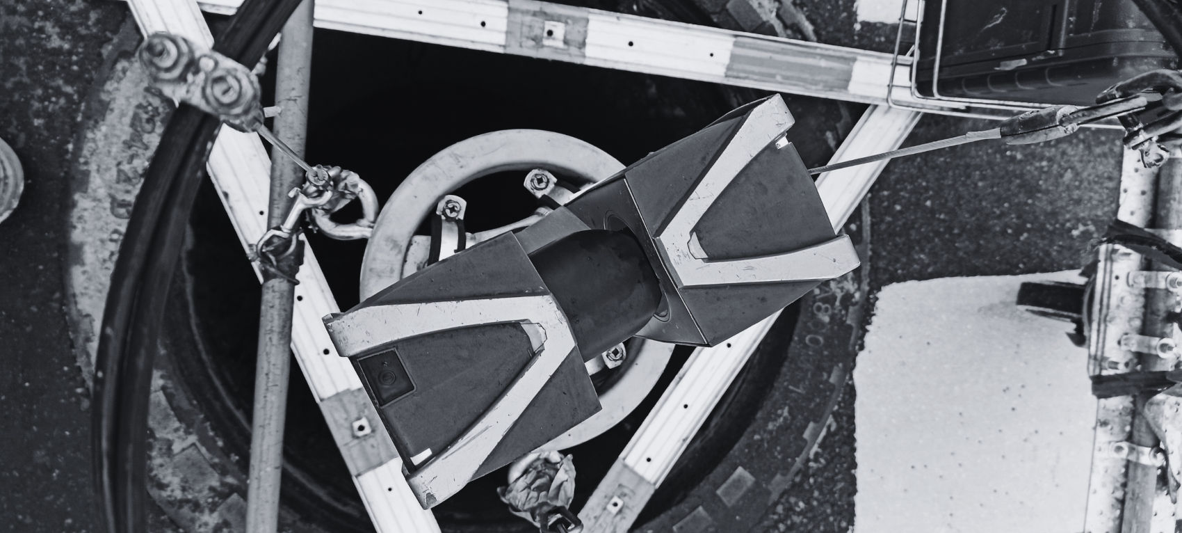
“We scanned the manholes with a 3D laser scanner. The equipment was lowered into the manholes from above. Initially, we had chosen a manhole tripod from one manufacturer, but tests showed it to be too slow and unsuitable for such a large-scale 3D laser scanning projects. Not only the performance of the equipment was unsatisfactory, but also the reliability – after scanning just 100 wells, it simply fell apart. After not finding a suitable solution, we had to create and manufacture a special device ourselves, capable of lowering the equipment into the wells quickly and safely,” explained Martynas Valauskis, the Survey Operations Manager at Terra Modus.
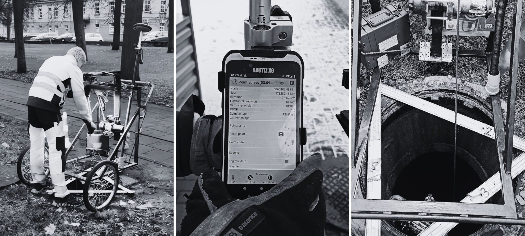
“We had to create and manufacture a special device ourselves, capable of lowering the equipment into the wells quickly and safely” – explained Martynas Valauskis, the Survey Operations Manager at Terra Modus
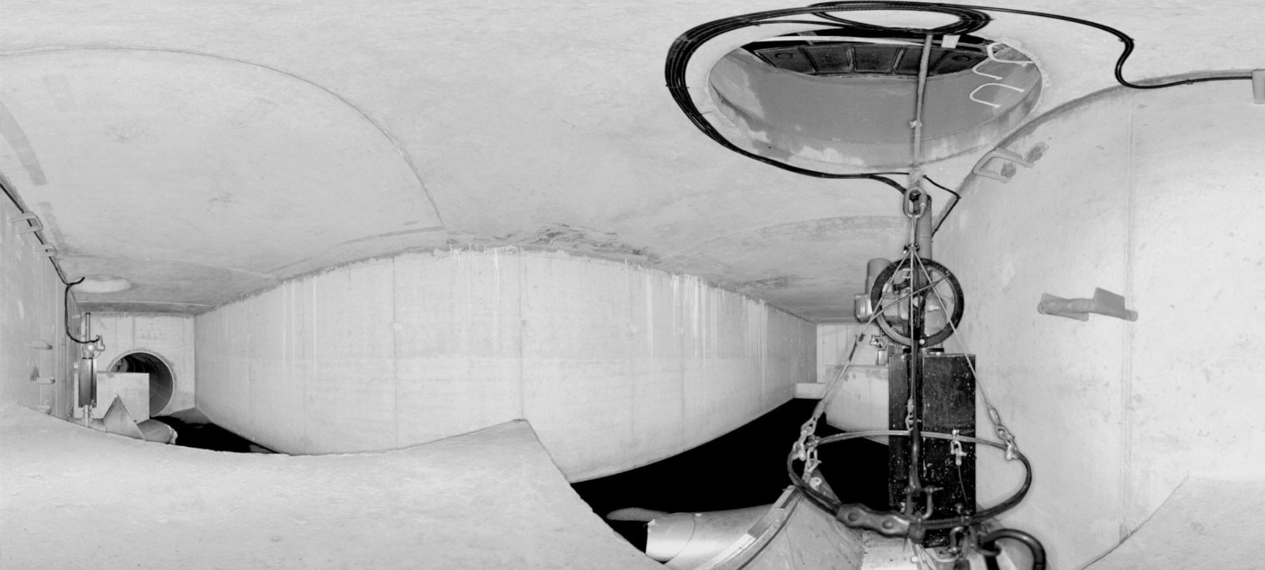
In traditional manhole surveying projects, surveyors typically perform scans inside the manhole and on the ground surface outside. The outside scan requires visible targets for georeferencing with GNSS measurements. All scans must be adjusted to a single coordinate system and georeferenced using a separate GNSS survey. Although capturing all necessary details inside the stormwater manhole can usually be accomplished with just one scan, correctly aligning it with an outside scan may require one or several intermediate scans along the route from the bottom to the top of the manhole.
To overcome these challenges, Terra Modus developed a system that enables to georeference the manhole to national grid coordinates and capture all critical details with just one interior scan in most cases. Terra Modus achieved this using Undet point cloud software and it’s expertise in AI. This development has resulted in significant time savings for manhole surveying projects.
Terra Modus developed a system that enables to georeference the manhole to national grid coordinates and capture all critical details with just one interior scan in most cases
The project was not only unique in its scope, but also in the fact that it was necessary to find new ways to efficiently, accurately and quickly collect all the necessary data. Previous examples of good practice from other countries show that collecting 3D laser scanning data from a single manhole takes up to an hour, while the methodology and equipment developed by the Lithuanians has made it possible for the same task to be completed in just 5 minutes. Leading to an impressive total of 12,500 manholes assessed in just 6 months.
For Terra Modus, even before beginning the measurements, it was necessary to solve various problems that have not been solved in Lithuania before and to ensure that the chosen 3D scanners and the Lithuanian-developed Undet point cloud software would be capable of completing the task. The results exceeded all expectations. Artificial intelligence also played a significant role here, with the program used making it possible to check the quality of the measurement and determine the main parameters of the manholes in a semi-automatic way.
The project was not only unique in its scope, but also in the fact that it was necessary to find new ways to efficiently, accurately and quickly collect all the necessary data

Previous examples of good practice from other countries show that collecting 3D data from a single manhole takes up to an hour, while the methodology and equipment developed by the Lithuanians has made it possible for the same task to be completed in just 5 minutes.
The project partners translated the scanned data into final 3D models that will help to virtually assess the hydraulic capacity of the stormwater system and the parameters of the various sections of pipeline. This will make it possible to experiment and simulate various scenarios, and respond promptly and precisely to developments in the city. This is great news for residents and visitors to the city of Vilnius, because in the future there will be no need to wade through flooded streets and pavements when there is significant rainfall.
Terra Modus is a laser scanning company focused on reality capture and point cloud processing, typically delivering CAD files to architects and engineers designing the restoration, refurbishment, or building additions for existing structures. Deliverables often include 3D building information models (BIMs) or 2D floorplans and facades. The company also develops Undet point cloud software tools to streamline point cloud processing workflows and accelerate the production of accurate 2D, 3D & BIM deliverables based on 3D laser scan data.
New Tools in Undet for Revit Plugin for Efficient Point Cloud Modeling We’re thrilled to share new features and…
READ MORE
Modeling Architectural Elements from Point Clouds in SketchUp with UNDET Tools In the fields of architecture and construction, 3D…
READ MORE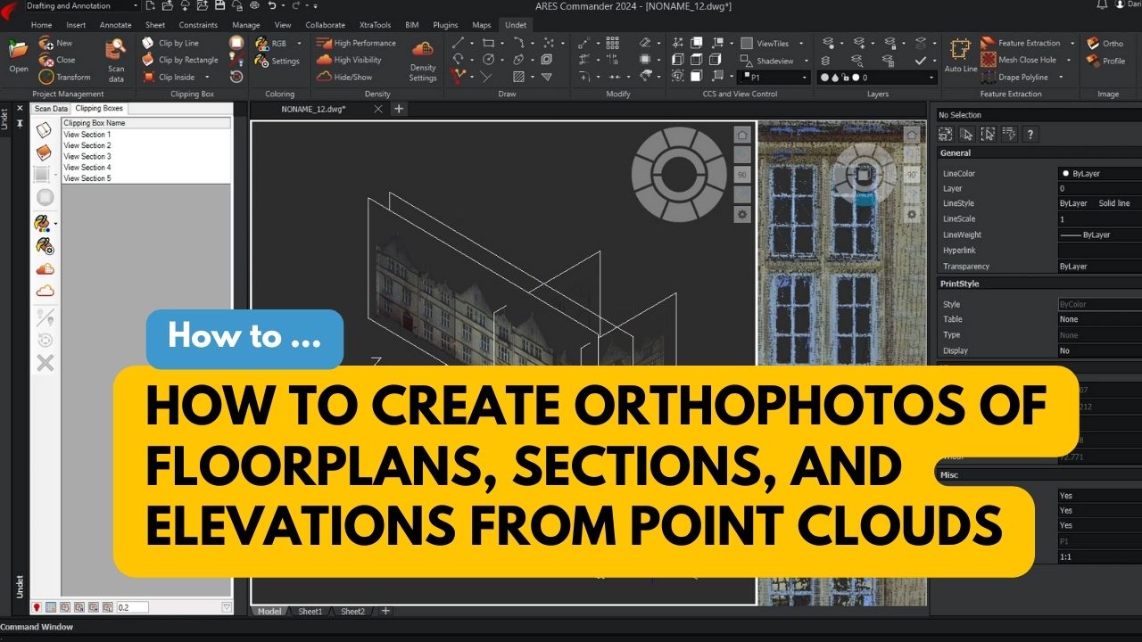
Orthophotos are images that show the true dimensions of objects, which can be used to accurately measure distances, areas, and…
READ MORE