Undet is a powerful yet simple plugin packed with well-thought-out point cloud tools to import, view, and model 3D laser scan data in ARES Commander software. For novice or experienced users, Undet adds value thanks to its intuitive workflow created by 3D measurement professionals just like you.
Undet for ARES Commander
Undet lets you import and handle point cloud data directly inside the ARES Commander from any 3D laser scanner or drone mapping system.
Specialized Tools for Floor Plan creation
In the Undet plugin, you will find built-in and ready-to-use templates, dynamic blocks, and specialized workspace to speed up the creation of accurate as-builts floor plans based on 3D point clouds.
Specialized Tools to Annotate Floor Plan Drawing using Undet Browser
In the Undet plugin, you will find specialized tools to annotate floor plan drawings using unique Undet point cloud viewer features with 50+ scripts.
Point cloud import from any laser scanner or drone: *.E57, *.FLS, *.RCP/RCS, *.PTX, *.ZFS,*.LAS, *.LAZ, *.PTS, *.PLY, *.DP, *.FPR, *.LSPROJ, *.FWS, *.CL3, *.CLR, *.RSP, ASCII / NEZ (X,Y,Z/i/RGB) and custom ASCII / TXT file format import.
Point cloud visualization tools adjust the colours of point clouds with a unique “auto contrast” feature. Colouring modes with additional settings: by source (RGB), by intensity, by plane, by Z, and by custom colours.
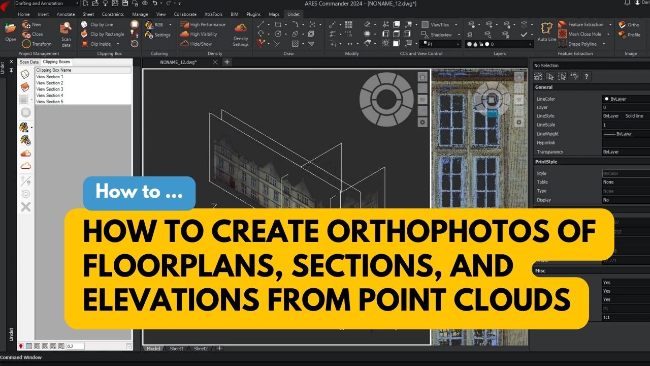
Bunch of easy-to-use tools for viewing and working with slices (view sections) of 3D point cloud data to easily control the information you see in your model view.
3D point cloud viewer integration to understand & see better what the point cloud represents, together with exclusive tools to relocate point cloud slices and 50+ scripts and blocks to annotate your drawings.
Surface meshing tools to automatically extract pure ground surface mesh with additional tools to edit extracted mesh: decimate, close holes, remove spikes, remove edges, join & export meshes, apply texture and create sections.
Specialized tools for floor plan creation to speed up the creation of accurate floor plans based on 3D point clouds.
Coordinates system manager to move your point cloud quickly and align scan data to the 3D model, UCS or move it to optimized coordinates to avoid screen glitching when working georeferenced point clouds.
To provide the best experiences, we use technologies like cookies to store and/or access device information. Consenting to these technologies will allow us to process data such as browsing behavior or unique IDs on this site. Not consenting or withdrawing consent, may adversely affect certain features and functions.
Functional
Always active
The technical storage or access is strictly necessary for the legitimate purpose of enabling the use of a specific service explicitly requested by the subscriber or user, or for the sole purpose of carrying out the transmission of a communication over an electronic communications network.
Preferences
The technical storage or access is necessary for the legitimate purpose of storing preferences that are not requested by the subscriber or user.
Statistics
The technical storage or access that is used exclusively for statistical purposes.The technical storage or access that is used exclusively for anonymous statistical purposes. Without a subpoena, voluntary compliance on the part of your Internet Service Provider, or additional records from a third party, information stored or retrieved for this purpose alone cannot usually be used to identify you.
Marketing
The technical storage or access is required to create user profiles to send advertising, or to track the user on a website or across several websites for similar marketing purposes.