What Is Point Cloud Modeling?

Point cloud modeling is the process of taking a 3D point cloud and transforming it into a 3D model, 2D plans or BIM deliverables. 

In this article, we will talk you through the process from how to create a point cloud, through to choosing the right point cloud modeling software and workflow for your architecture, construction, or restoration project.


How do you create a point cloud?


You usually need specialized hardware and software that is able to collect and process 3D spatial data in order to create a point cloud. As a general rule, the process to create a point cloud is as follows:

  • Reality Capture: The first step is to capture an existing building or object using devices such as LiDAR scanners or photogrammetry techniques.
  • Data Processing: Once the data is captured, it needs to be processed to generate a point cloud. This involves aligning and registering multiple scans or images, removing noise or outliers, and optimizing the data for further analysis.
  • Point Cloud Editing and Cleaning: Sometimes, the point cloud may contain unwanted elements. In such cases, editing and cleaning processes are applied to remove irrelevant data points, noise, or some parts of the captured data.
  • Point Cloud Utilization: Once you have a clean and accurate point cloud, you can transform it into your required deliverables (2D plans or 3D/BIM models) by using point cloud modeling software.


What is point cloud software?


Point cloud software is designed to help you import and work with point cloud data. Typically, it comes in the form of plugins and extensions that are used within popular CAD programs such as AutoCAD, Revit, ARES Commander, and SketchUp. With the help of point cloud plugins, such as Undet, you can easily convert point cloud data into meshes, which can be used to make complete 3D models and 2D deliverables.


How to choose the right point cloud modeling software for you?


When choosing the right point cloud modeling software for you, there are several factors you need to consider:

  • Compatibility: Firstly, it is important to check that the software you choose is compatible with the point cloud data format generated by your scanning equipment. Common formats include E57, LAS (LiDAR), PTS,  PLY, XYZ, and PTX. 
  • Functionality: Carefully evaluate the features and functionalities of the different software available on the market. Consider your specific needs and determine whether the software provides the tools required to meet your specific point cloud modeling needs. Also, look for and consider whether the software provides automated or semi-automated processes, as these may significantly reduce the time needed to do certain tasks.
  • Ease of Use: User-friendly software can enhance productivity and reduce the learning curve for both new and experienced users. Look for intuitive interfaces, efficient workflows, and good technical support provided by the software vendor. 
  • Cost: Determine your budget for point cloud modeling software and compare the cost against the features and capabilities it provides. Some vendors also offer free trial periods, which will allow you to even better asses the software and see how the features may save you time and money. 

Recommended software for point cloud modeling


There is a long list of software options available for point cloud modeling, each with its own strengths and weaknesses. Here are some of the most popular and widely used CAD software programs that can be used in conjunction with Undet’s plug-ins to speed up and improve the point cloud modeling process:

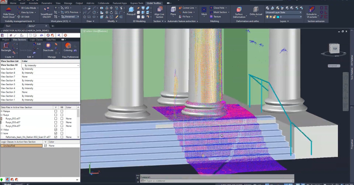
  • Autodesk AutoCAD: AutoCAD is one of the most popular CAD programs available on the market for working with point clouds. Undet software integrates perfectly with AutoCAD, supplementing the well-known system interface with specialist high-performance point cloud management tools.
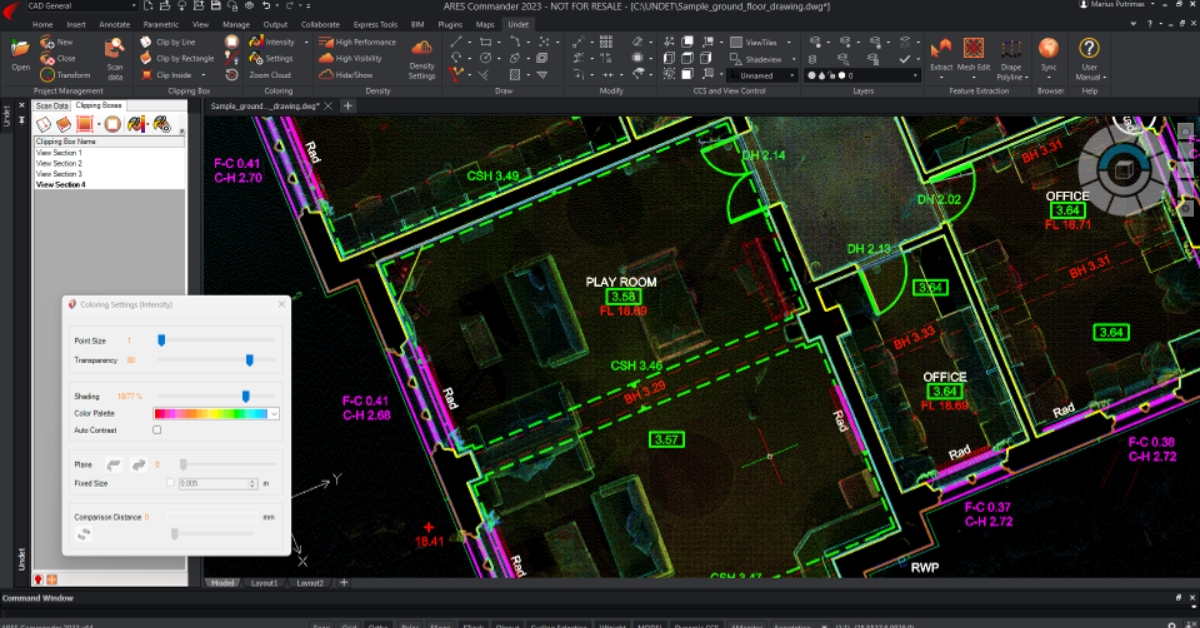
  • ARES Commander: ARES Commander is a cost-effective alternative to AutoCAD. Combining powerful Undet software tools with ARES Commander lets you turn point clouds into 2D drawings quickly and easily on a tight budget.
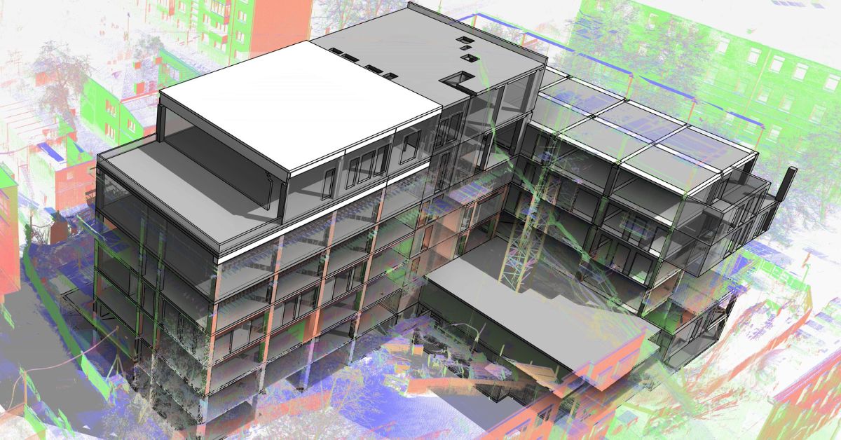
  • Autodesk Revit: Revit is a comprehensive Building Information Modeling (BIM) software that supports point cloud modeling (scan2bim). Undet for Revit software provides you with the necessary tools to speed up and streamline point cloud modeling in Revit.
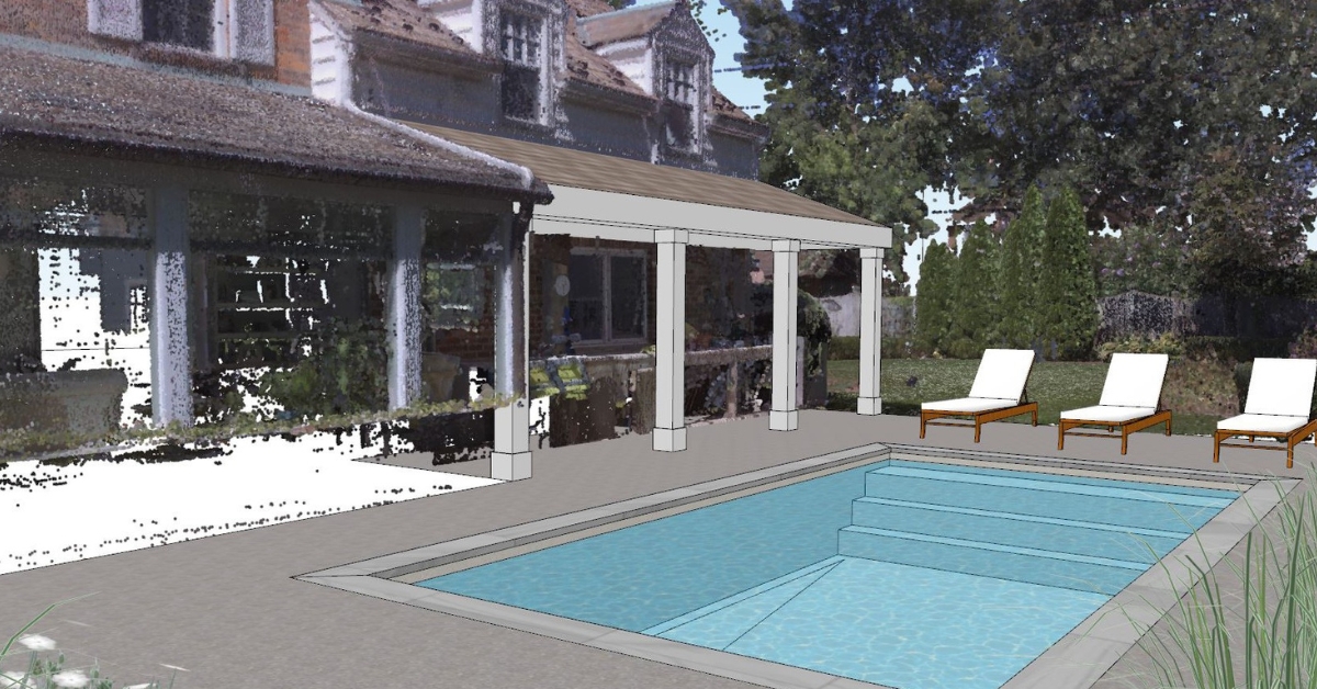
  • Trimble SketchUp: SketchUp is a 3D modeling software known for its user-friendly interface and intuitive design tools. Undet for SketchUp provides a wide range of high-end tools for point cloud modeling in SketchUp.


How to choose the right point cloud modeling workflow for you?


As simple as it may sound, the most efficient point cloud modeling workflow is most often achieved when using the CAD software that you know best. If you currently use AutoCAD, Revit, SketchUp or ARES Commander, then Undet’s specialist plug-ins will provide you with all the tools you need to complete and manage your point cloud modeling projects.

However, dependent on your specific architecture, construction, or restoration project, you may need to produce different kinds of deliverables (2D drawings, 3D models, BIM/IFC models). As a result, certain CAD software be a better fit, providing you with more efficient and intuitive workflows.

If you are interested in 2D documentation (floor plans, sections, elevations), you should go with AutoCAD + Undet, or if you are looking to save some money then go with ARES Commander + Undet. Both options are perfect for doing this kind of job.

If you are more focused on BIM modeling using point clouds (scan2bim) and working on large-scale projects, consider using Autodesk Revit + Undet software. Lastly, if you are working more with projects that require 3D modeling tools and 3D deliverables, consider using SketchUp + Undet.

ares commander interface ground floor sample drawing dwg

2D as-built documentation from Point Clouds. Point Cloud modeling software: ARES Commander + Undet.

point cloud software interface

Accelerating Point Cloud processing and enhancing accuracy: Point Cloud modeling in AutoCAD with Undet

complete 3d model made with undet plug in and revit

Point Cloud modeling software: Revit + Undet.

realistic 3d visual sketchup undet

Creating realistic 3D visuals from laser Sscanning and point cloud data for enhanced architectural presentations and planning. Point Cloud modeling software: SketchUp + Undet.

What are the benefits of using Undet for point cloud modeling in Revit, AutoCAD, ARES Commander or SketchUp?


  • Utilize large point clouds efficiently. Undet allows users to work efficiently with large point clouds to simplify their management for viewing and working with slices to understand the structure of objects quickly and find what you need to see.
  • Increase your profits. Get the job done faster with intuitive point cloud extraction tools that will increase efficiency when working on point cloud modeling projects.
  • Ensure better deliverables. Produce reliable, accurate results based on point clouds captured with any laser scanner.
  • Get expert advice & guidance. Undet’s knowledgeable team is always on hand to provide the support you need, from a free tutorial call to specific technical assistance. We also have an extensive knowledge base full of helpful articles and how-to videos.


Still not sure if Undet is right for you?


You can try Undet for SketchUp for free for 14 days, or Undet for AutoCADRevit and ARES Commander for 30 days. This is not a stripped-down trial, you have full access to the software just like if you have just bought a license. Not only that, we will schedule a tutorial call to show you the features of the software and how they work. Allowing you to get to work and start reaping the benefits of Undet even quicker.

Ready to try?

Download Undet and start reaping the benefits!

A point cloud is a set of data points in 3D space, generated by scanning an object or surface. Each point in the cloud contains X, Y, Z and orientation values, as well as sometimes colour or intensity measurements. These points can be thought of like pixels in a picture that come together to create a recognizable 3D structure. Point clouds are typically made up of thousands, or even millions, of individual points. 

A point cloud is called a point cloud because it is a collection of thousands or millions of data points in 3-dimensional space. Each of these points contains data on its location (x, y, z), as well as sometimes additional data such as colour or intensity.

A point cloud is essentially a simple 3D model which is made up of thousands or millions of small dots (known as points), each containing X, Y, Z values, orientation information, as well as sometimes colour and intensity measurements. However, this is quite far from being a complete model that can be delivered to clients or used in a construction project. This is why it is more commonly known as just a point cloud rather than a model, because it is the basis from which proper 3D models and 2D deliverables can be made.

The main difference between a point cloud and a 3D model is that a 3D model is a computer-generated representation of an object, or surface, while a point cloud is a set of individual data points in 3-dimensional space.

No, points clouds and LiDAR are not the same. LiDAR stands for “Light Detection and Ranging”, and is a remote sensing technology that uses laser pulses to map an area or building. Whereas a point cloud is a large set of data points in 3D space, generated using LiDAR or other technologies such as photogrammetry.

The main difference between a point cloud and a mesh is that a mesh is made up of interconnected triangles or polygons that form a solid 3D surface, while a point cloud is a collection of millions (or sometimes billions) of individual points in 3D space. Meshes can be created from point cloud data using CAD software.

Blog